The Great Escape 2026 · Éislek, Luxembourg
100 km run
- Distance
- 105.7 km
- Climb
- ≈4,200 m
- Aid stations
- 4
Enscherange → Clervaux · start Sat 19 Sep, 18:00
Where the route carries a white bead it runs on the waymarked Escapardenne, the Eisleck Trail or the Lee Trail. The plain line is new ground.
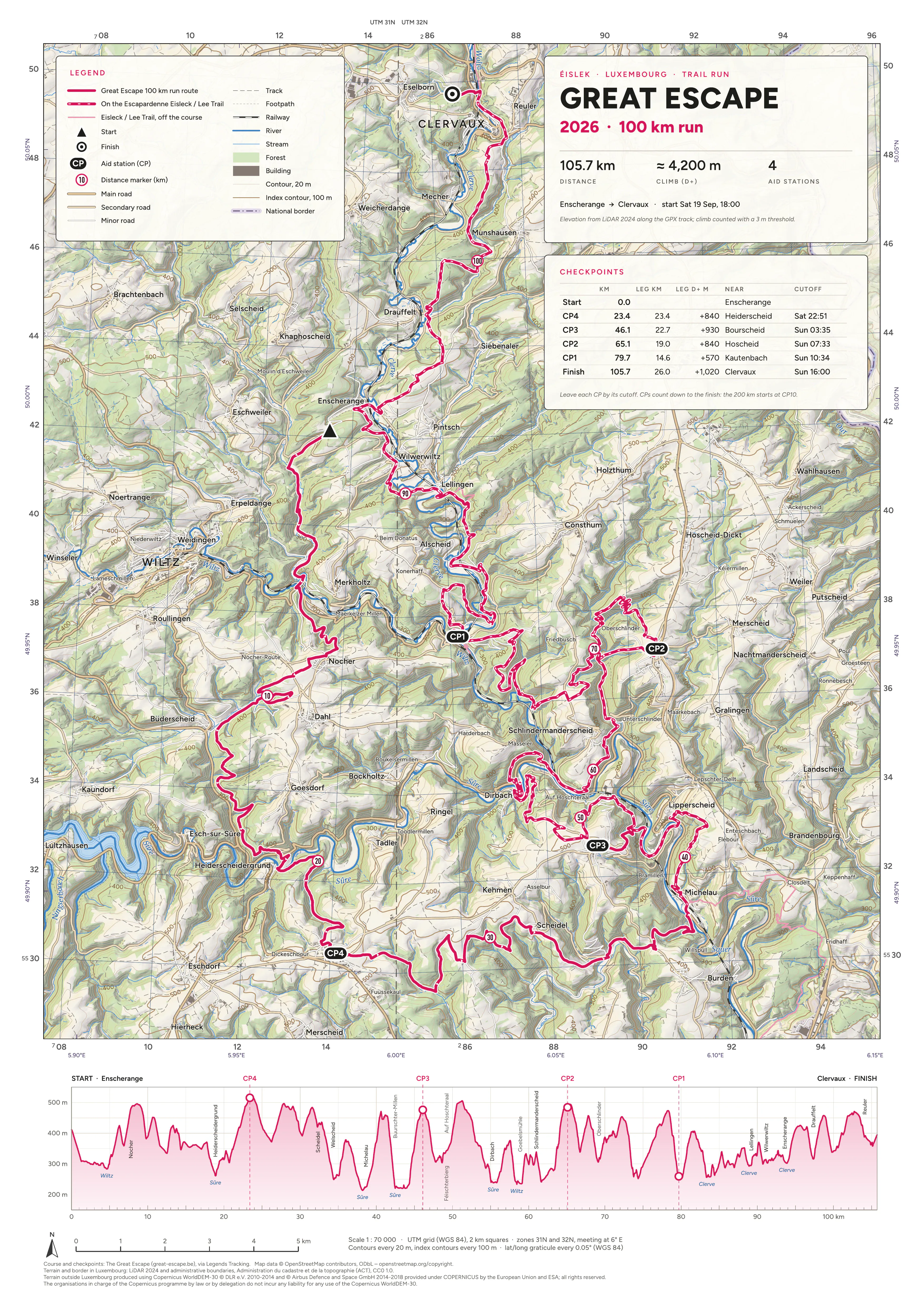
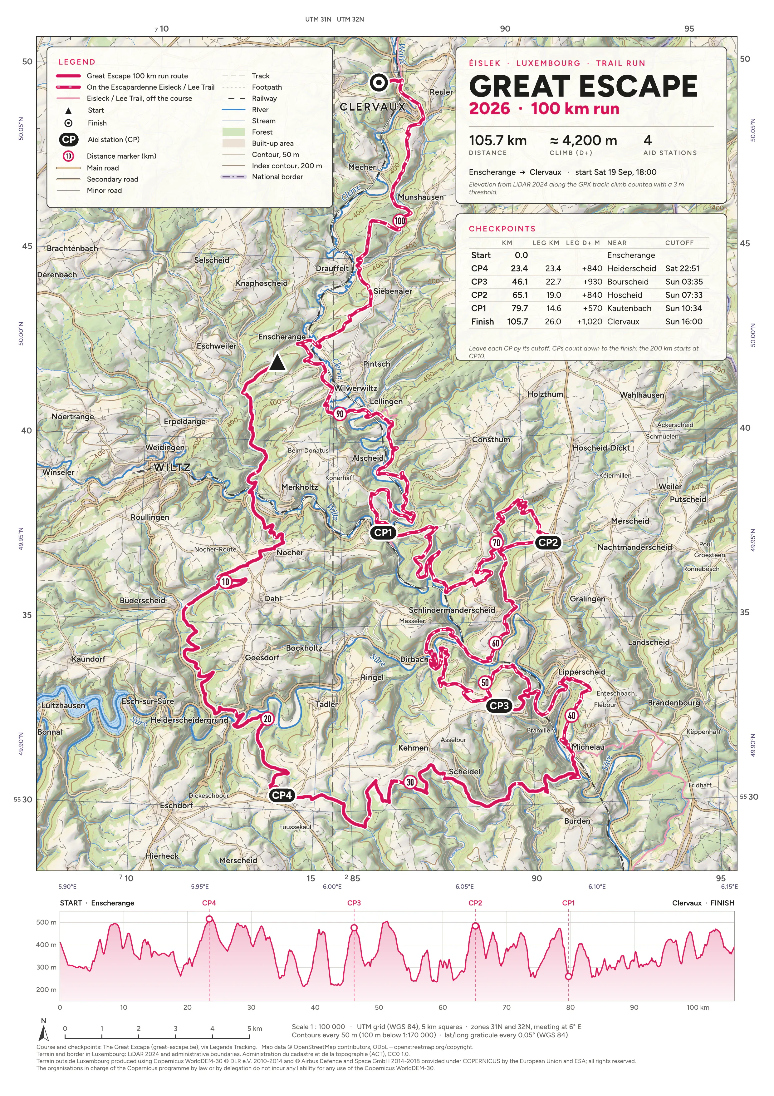
Tap or click a sheet to zoom in. The PDFs are georeferenced, so map apps that read GeoPDFs (Avenza Maps, for one) can show your position on them.
Credits
- Course and checkpoints: The Great Escape (great-escape.be), via Legends Tracking.
- Map data © OpenStreetMap contributors, ODbL. openstreetmap.org/copyright
- Terrain and border in Luxembourg: LiDAR 2024 and administrative boundaries, Administration du cadastre et de la topographie (ACT), CC0 1.0. data.public.lu
- Terrain outside Luxembourg produced using Copernicus WorldDEM-30 © DLR e.V. 2010-2014 and © Airbus Defence and Space GmbH 2014-2018 provided under COPERNICUS by the European Union and ESA; all rights reserved. The organisations in charge of the Copernicus programme by law or by delegation do not incur any liability for any use of the Copernicus WorldDEM-30.