Skye Trail · Isle of Skye, Scotland
Northbound
- Distance
- 129.1 km
- Climb
- ≈3,500 m
Broadford → Rubha Hunish
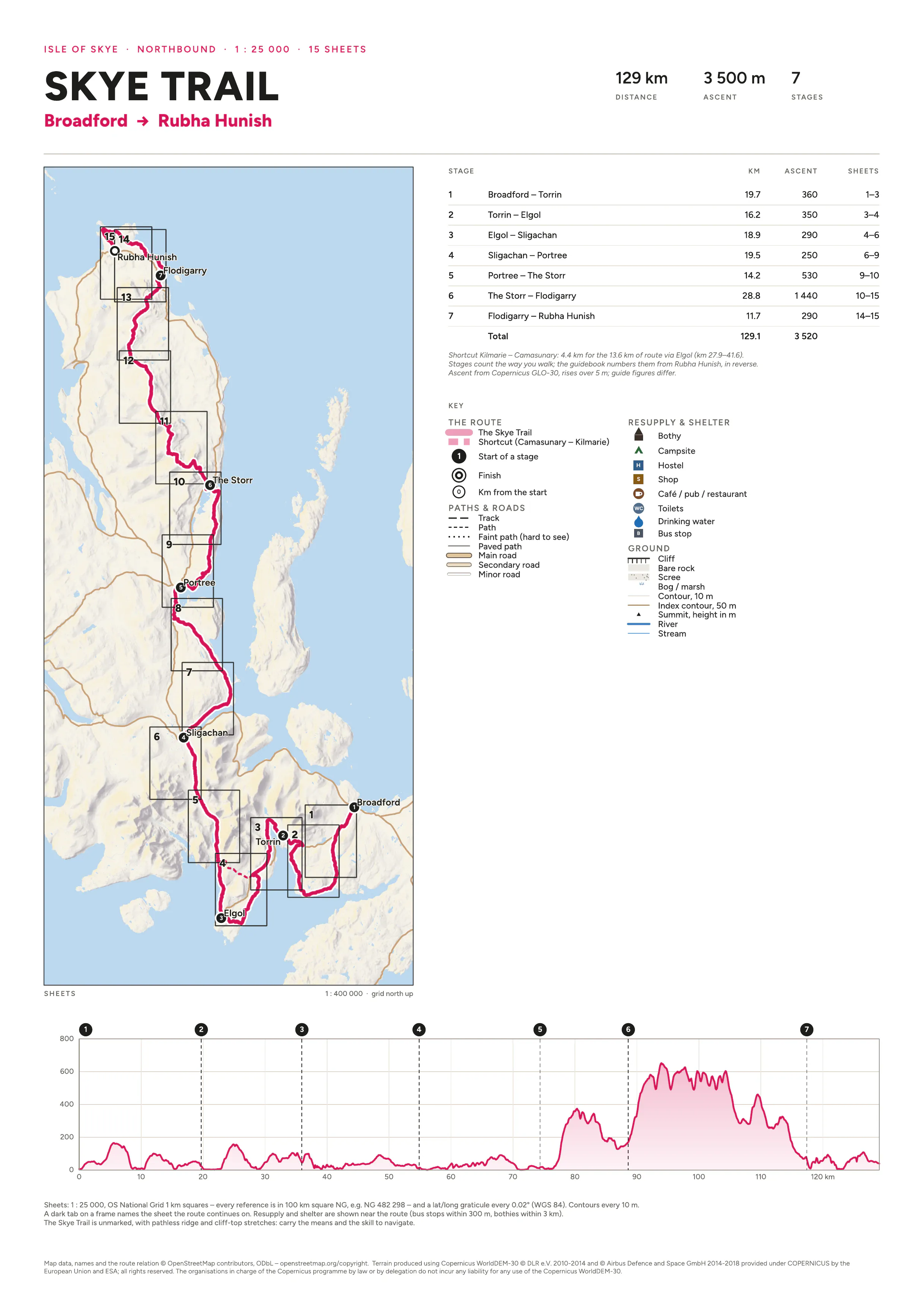
Seven stages from Broadford past Boreraig and Elgol, through Glen Sligachan and over the Trotternish ridge to Rubha Hunish. Km markers, stage numbers and the sheet order all count from Broadford, and a tab on each frame names the sheet the route continues on. The Kilmarie–Camasunary shortcut, cliffs, and resupply and shelter near the route are marked. The trail itself is not: it has pathless ridge and cliff-top stretches, so carry the means to navigate. The climb comes from a 30 m elevation model.
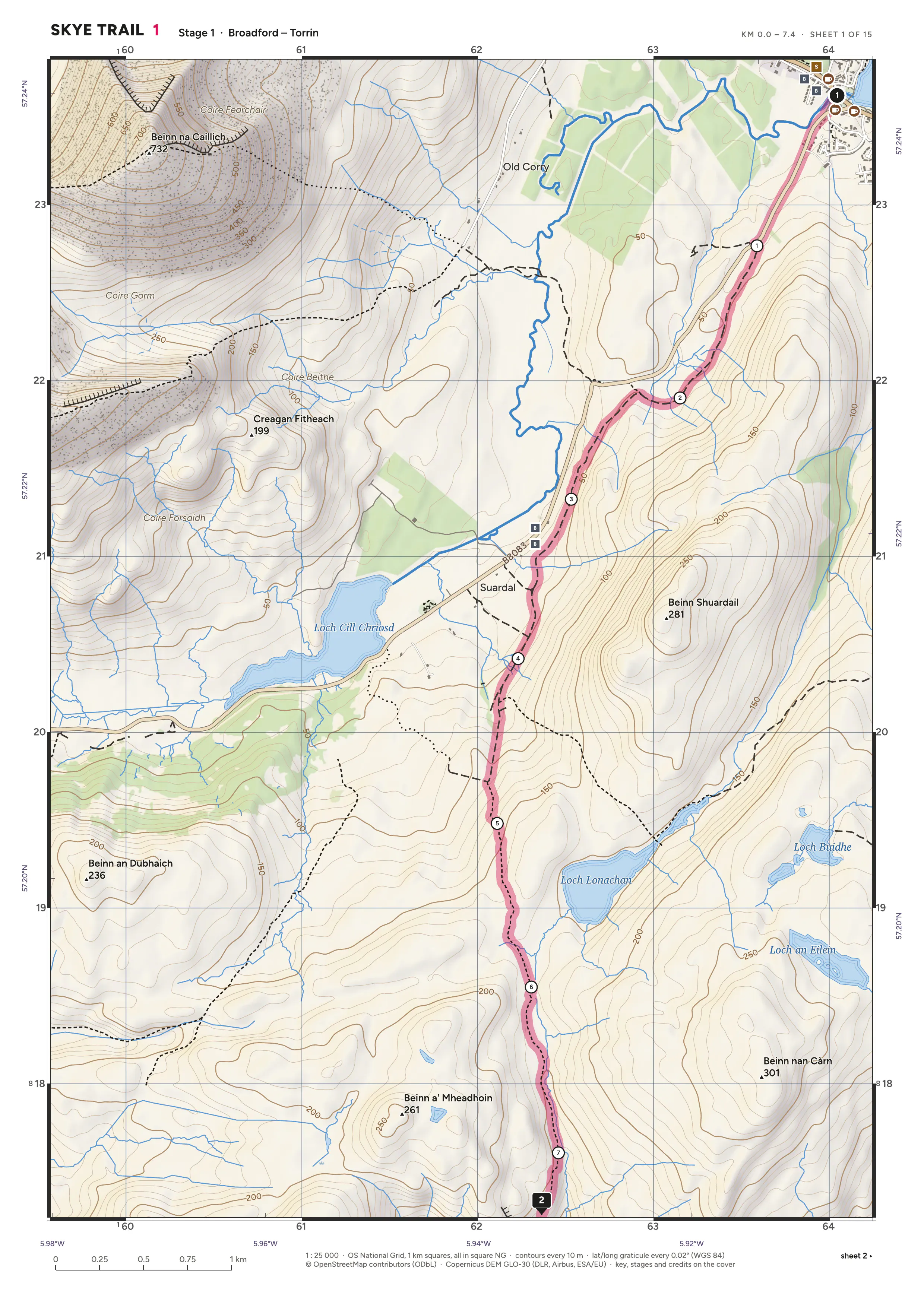
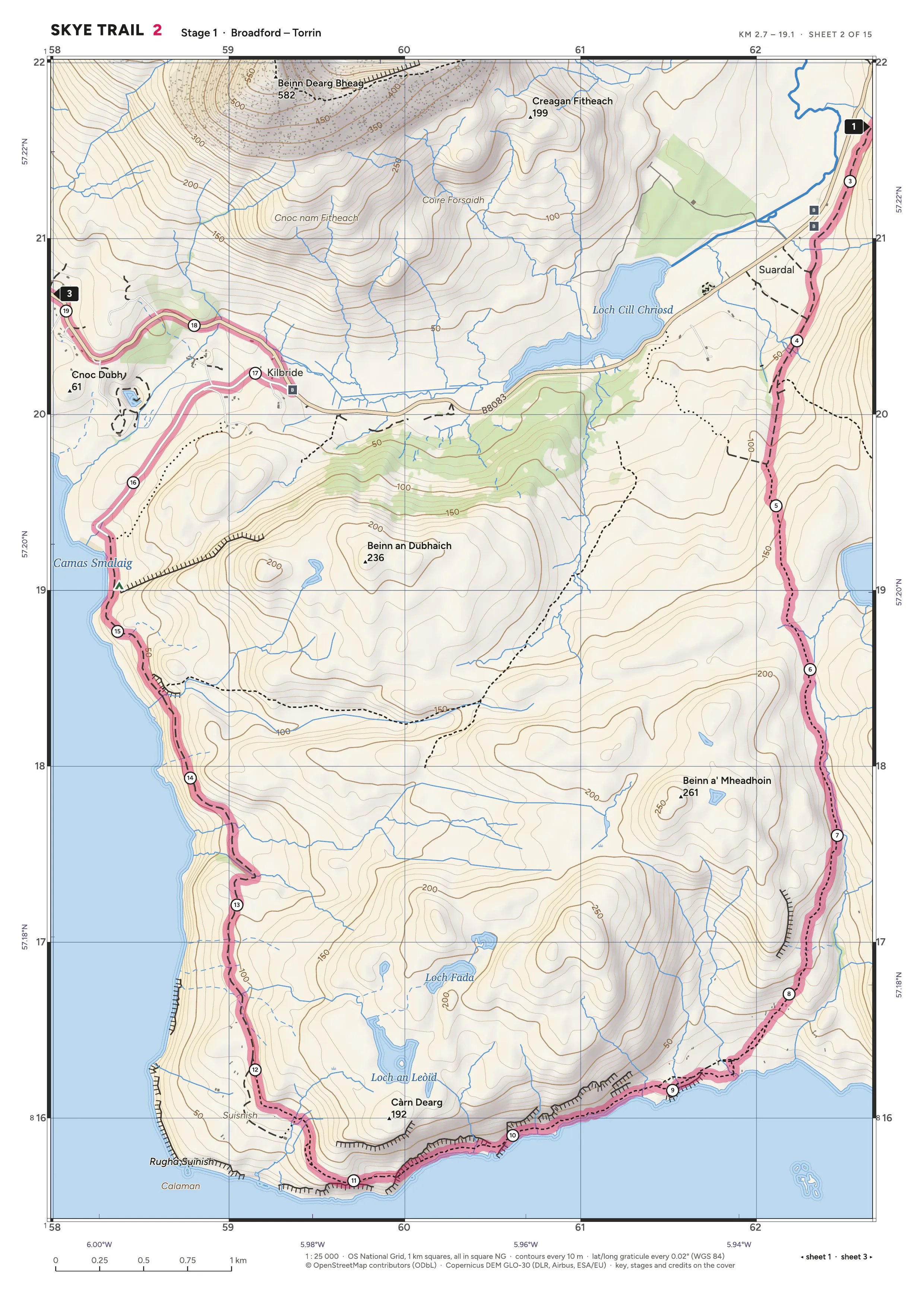
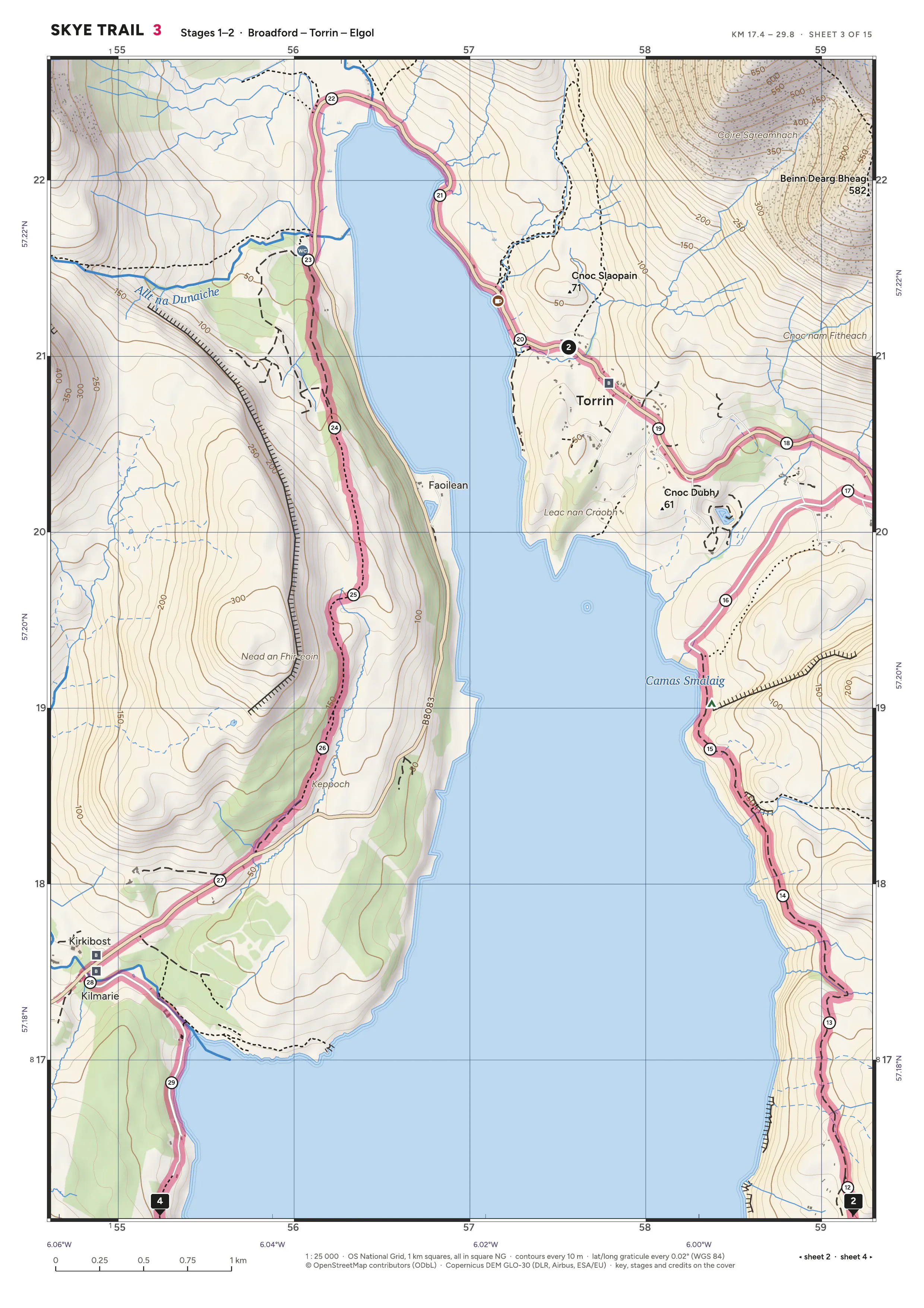
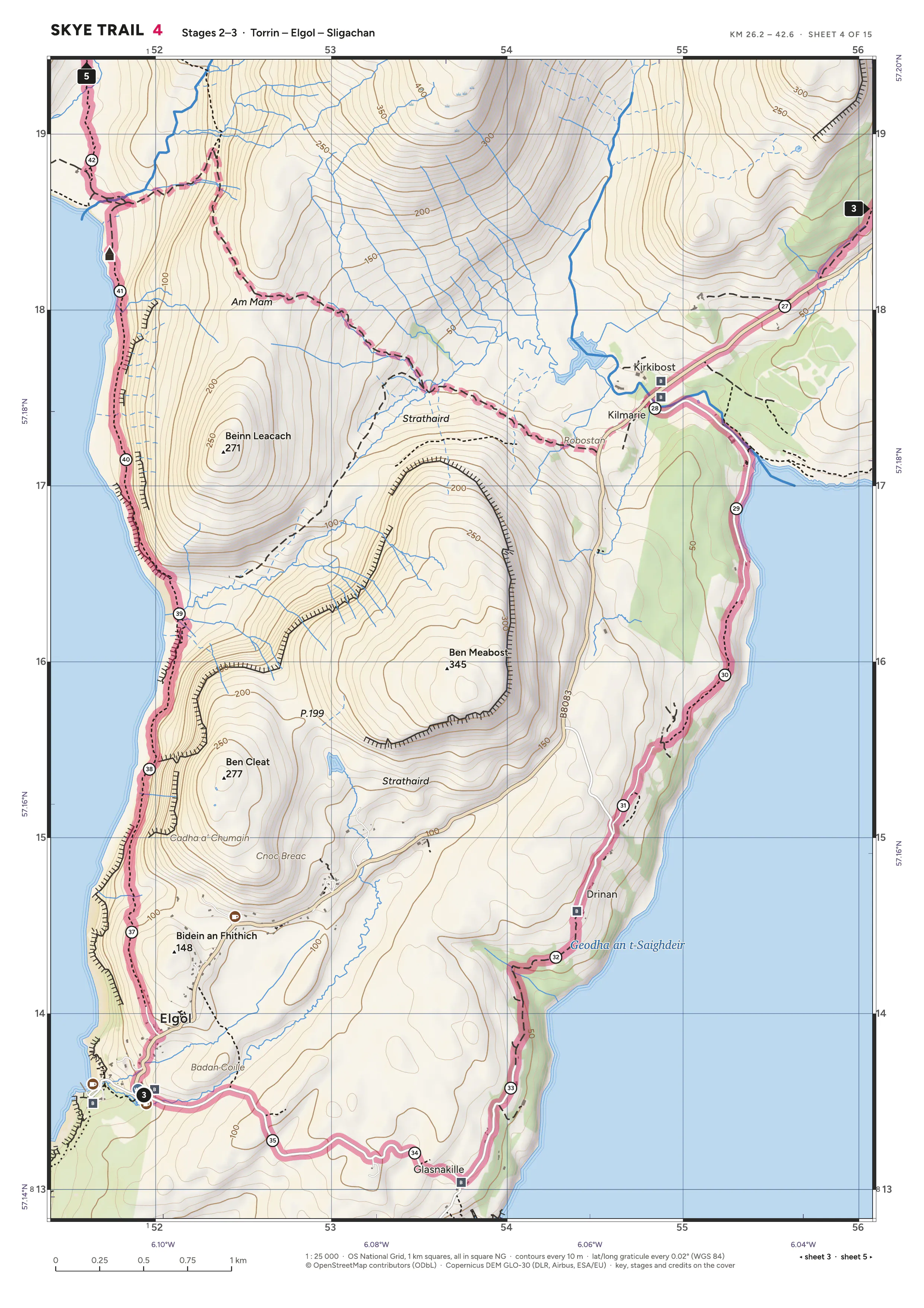
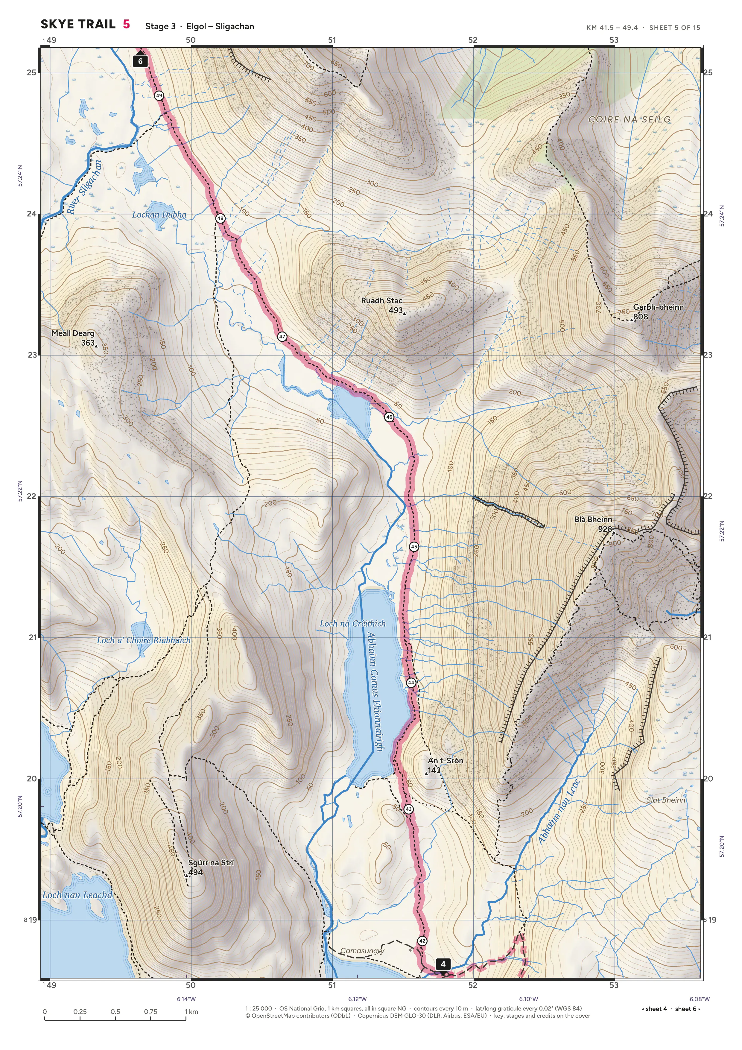
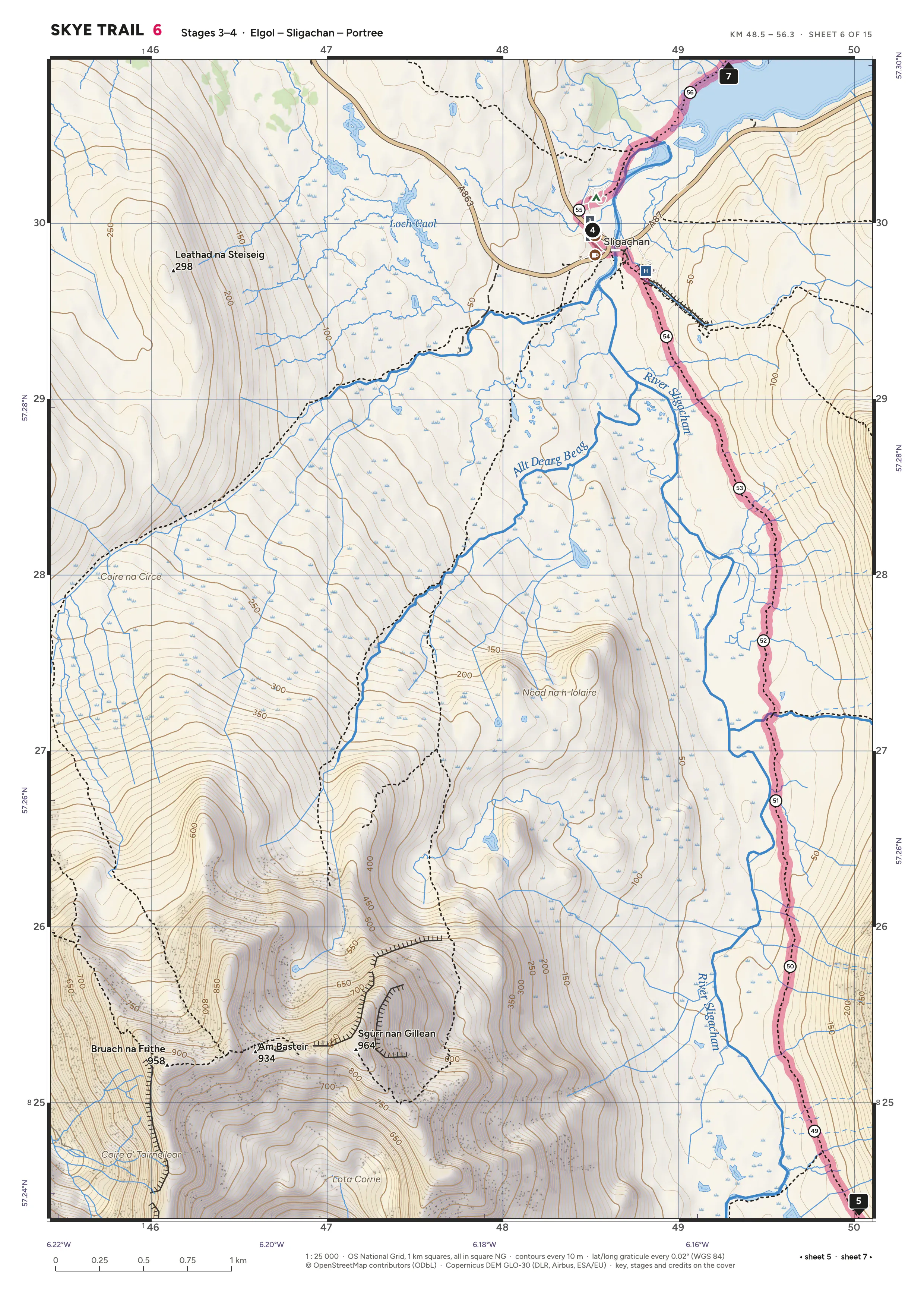
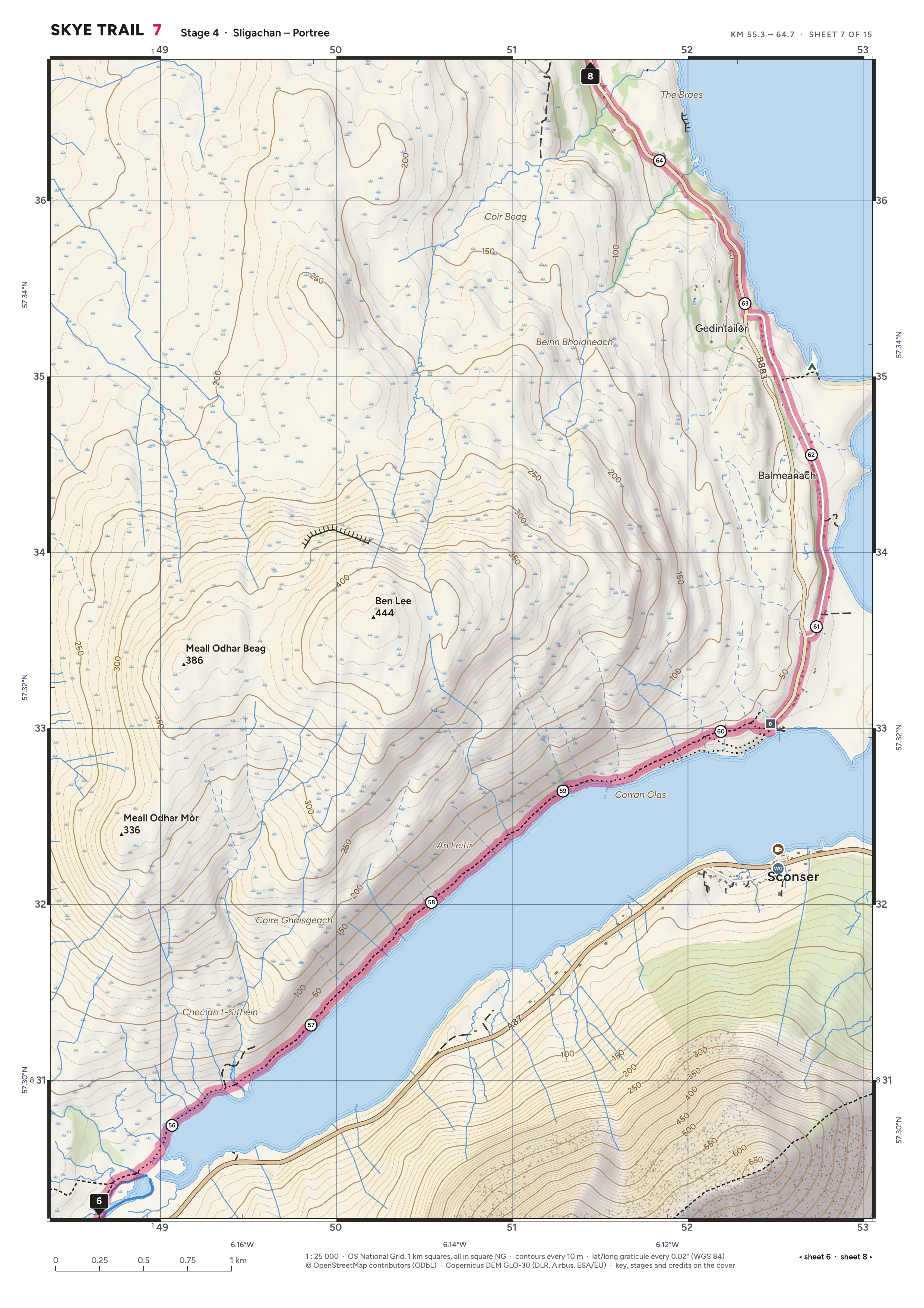
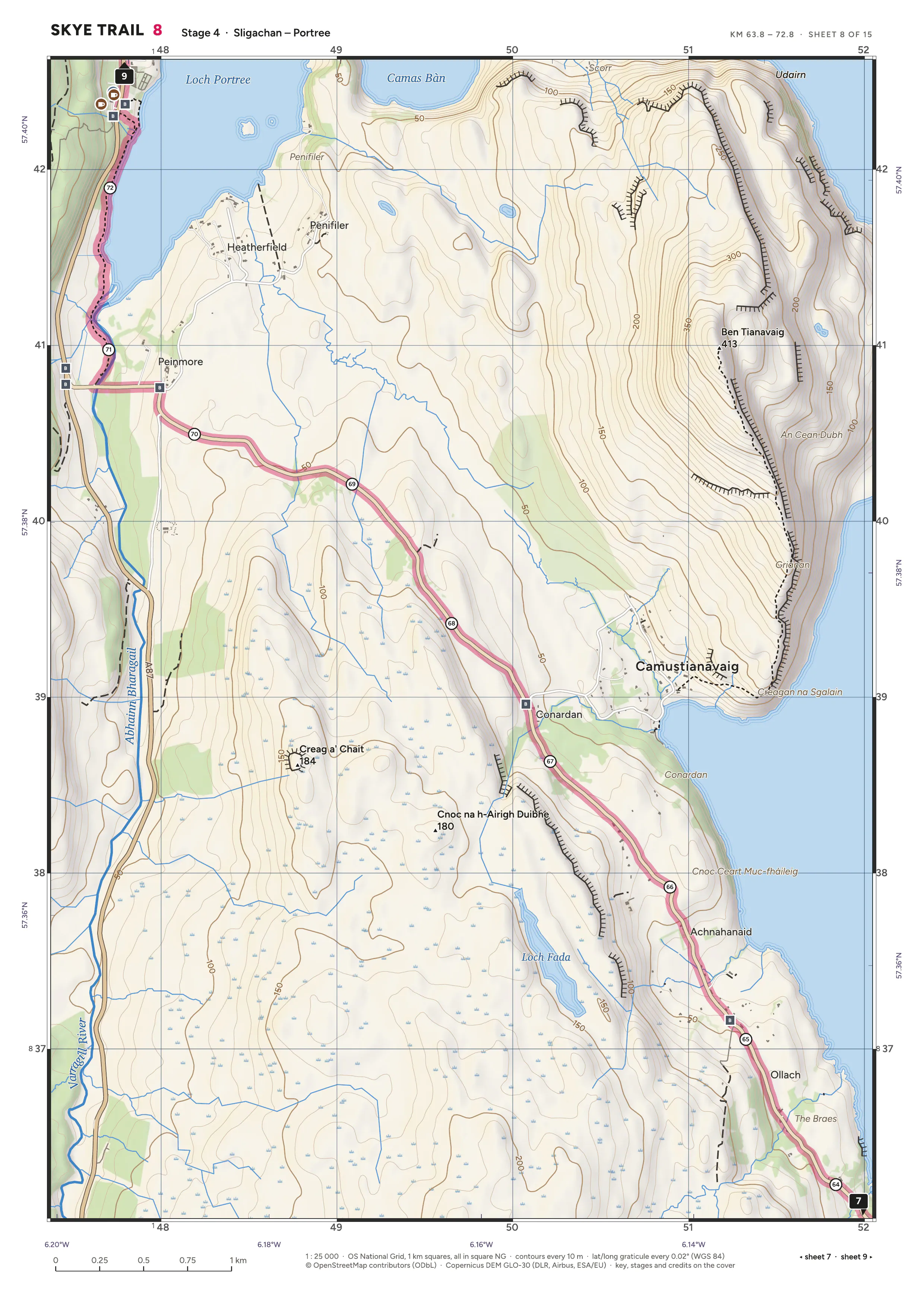
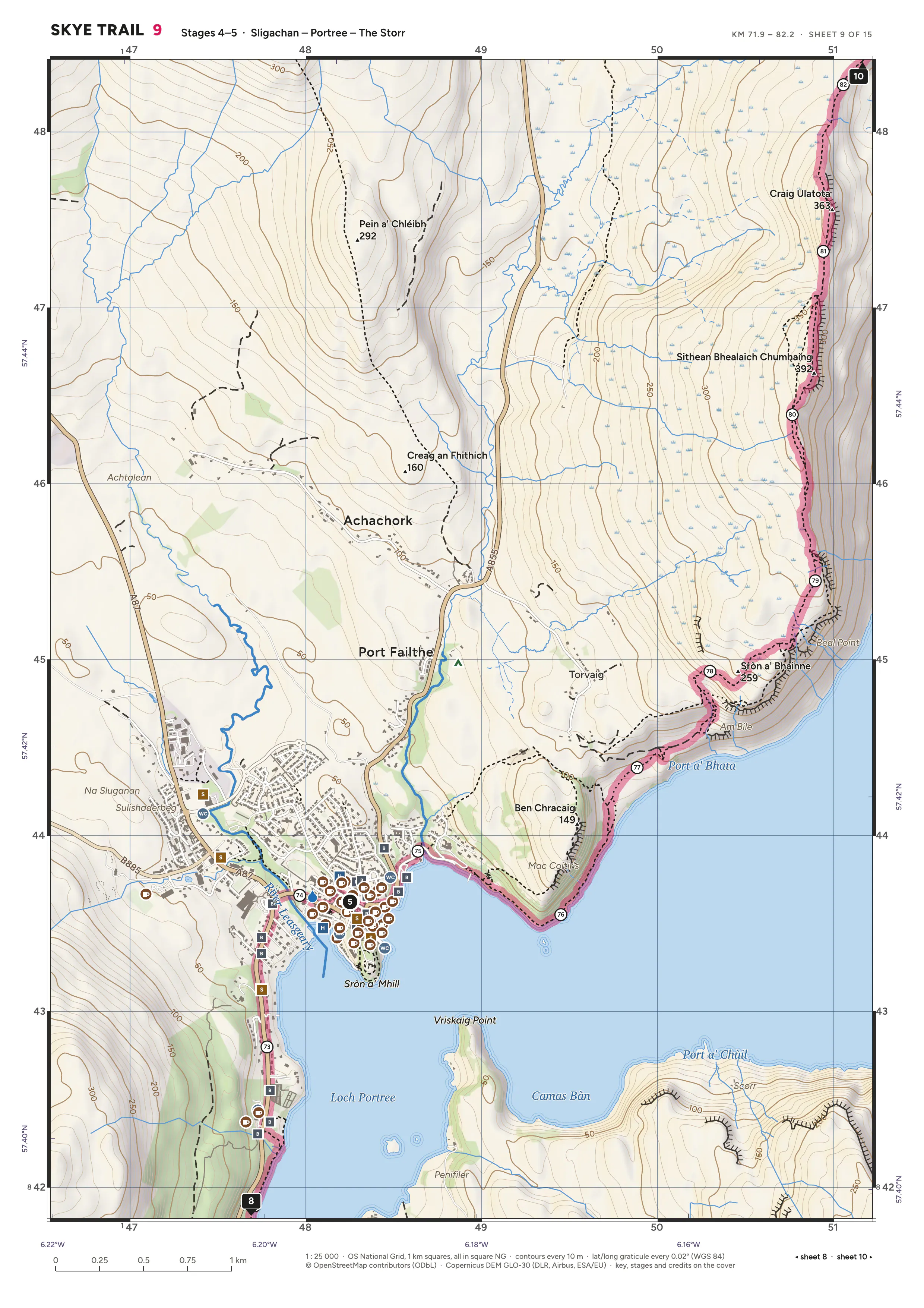
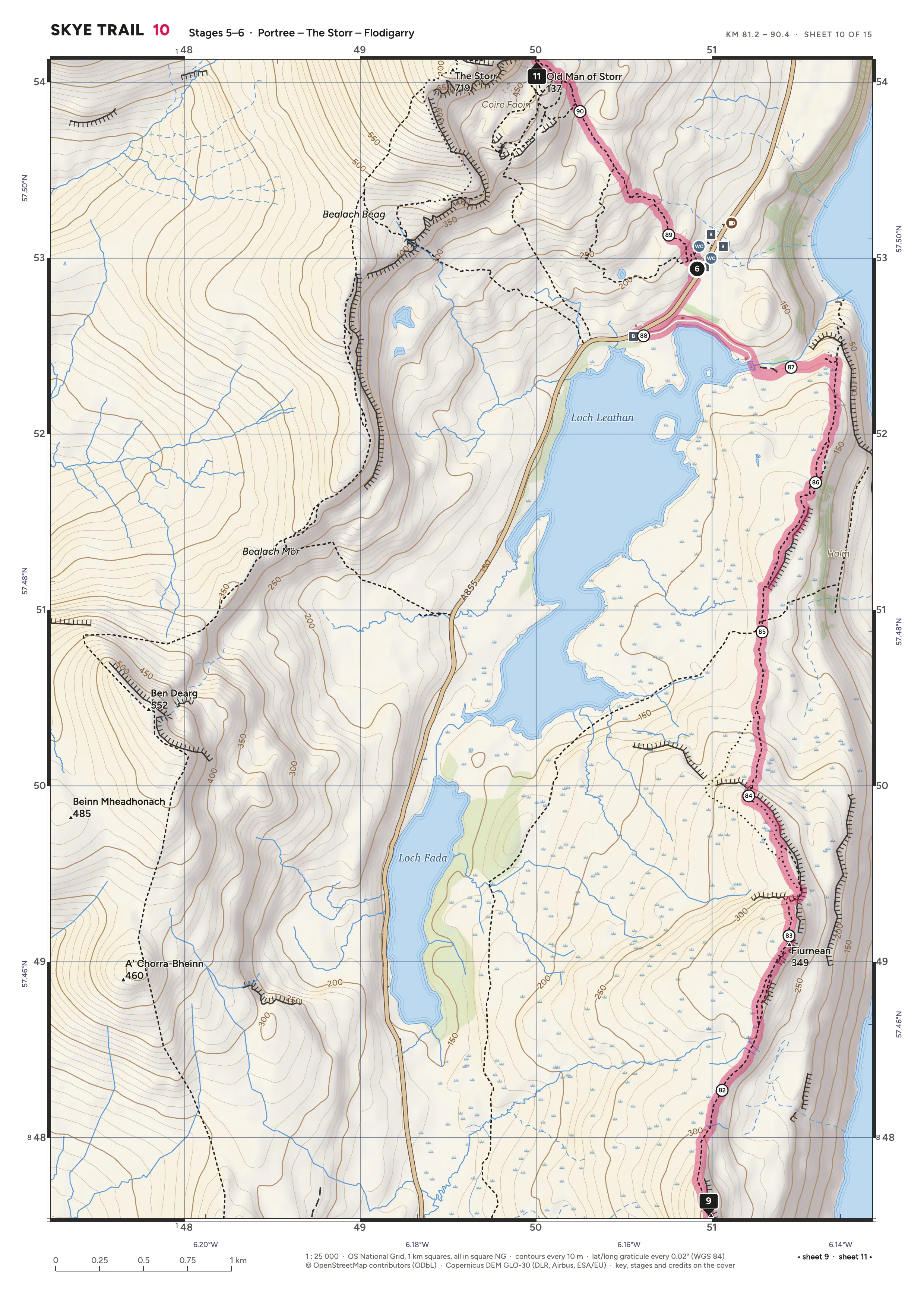
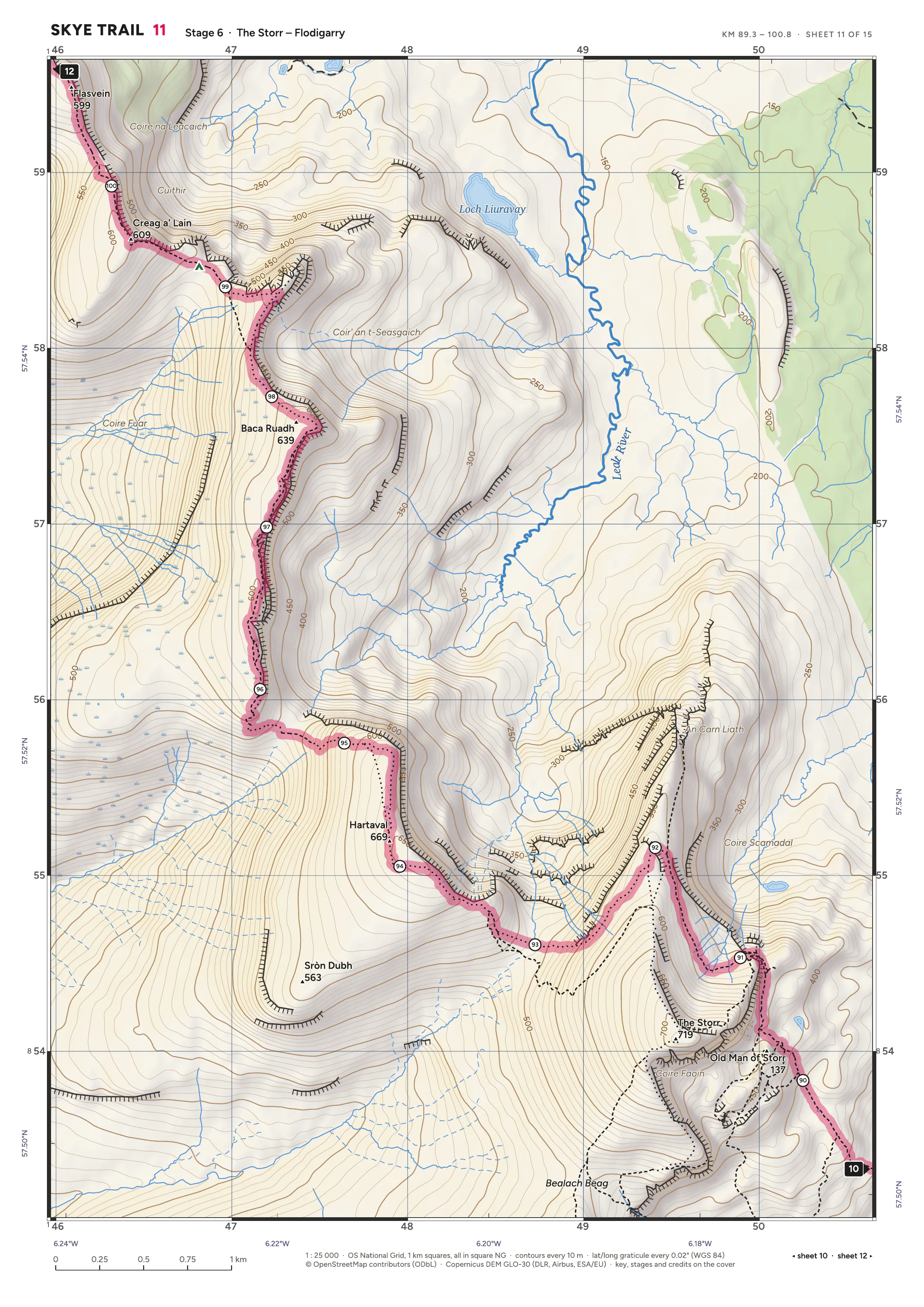
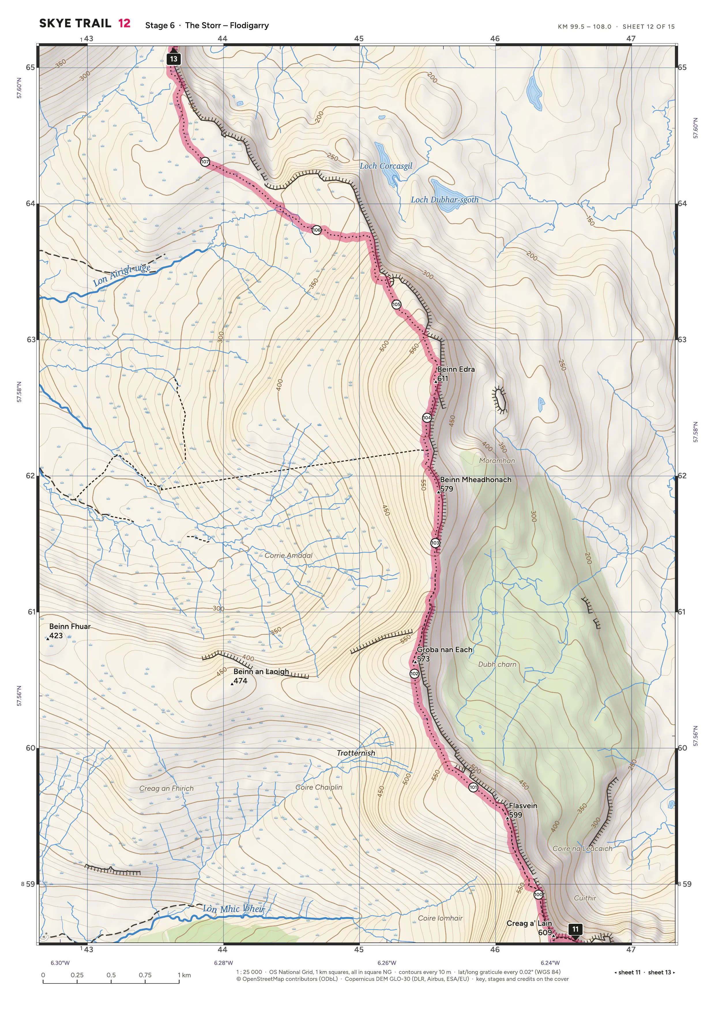
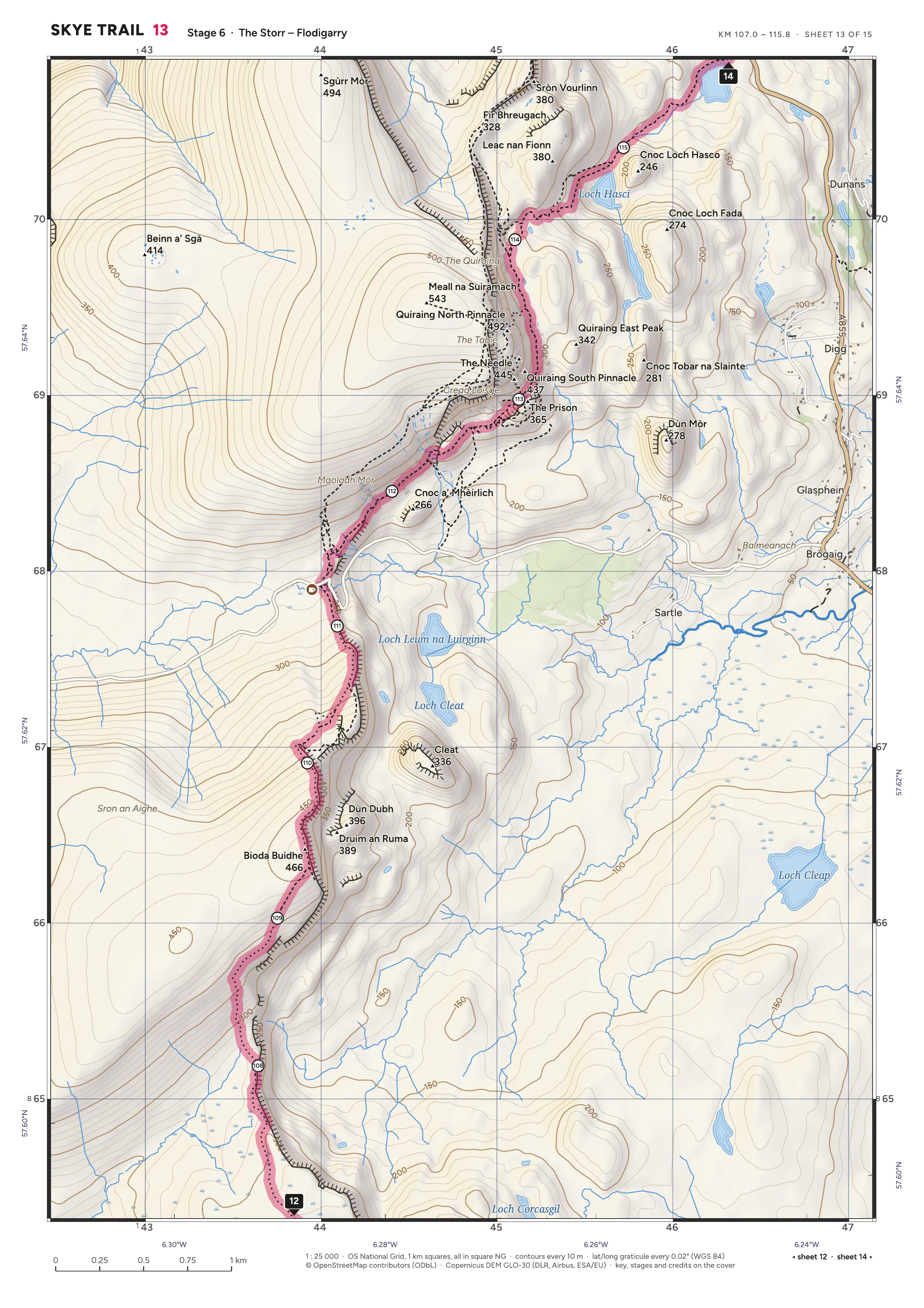
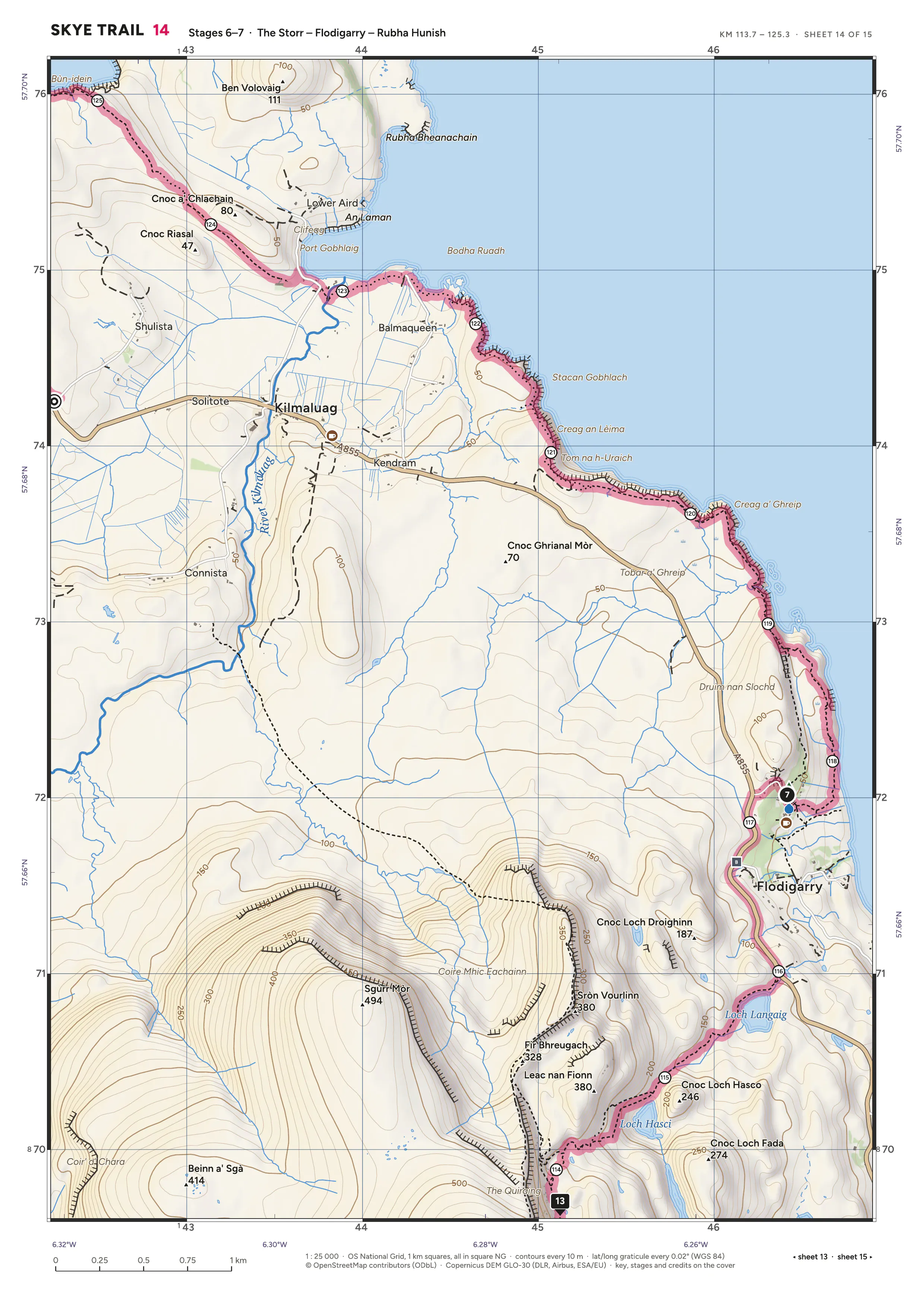
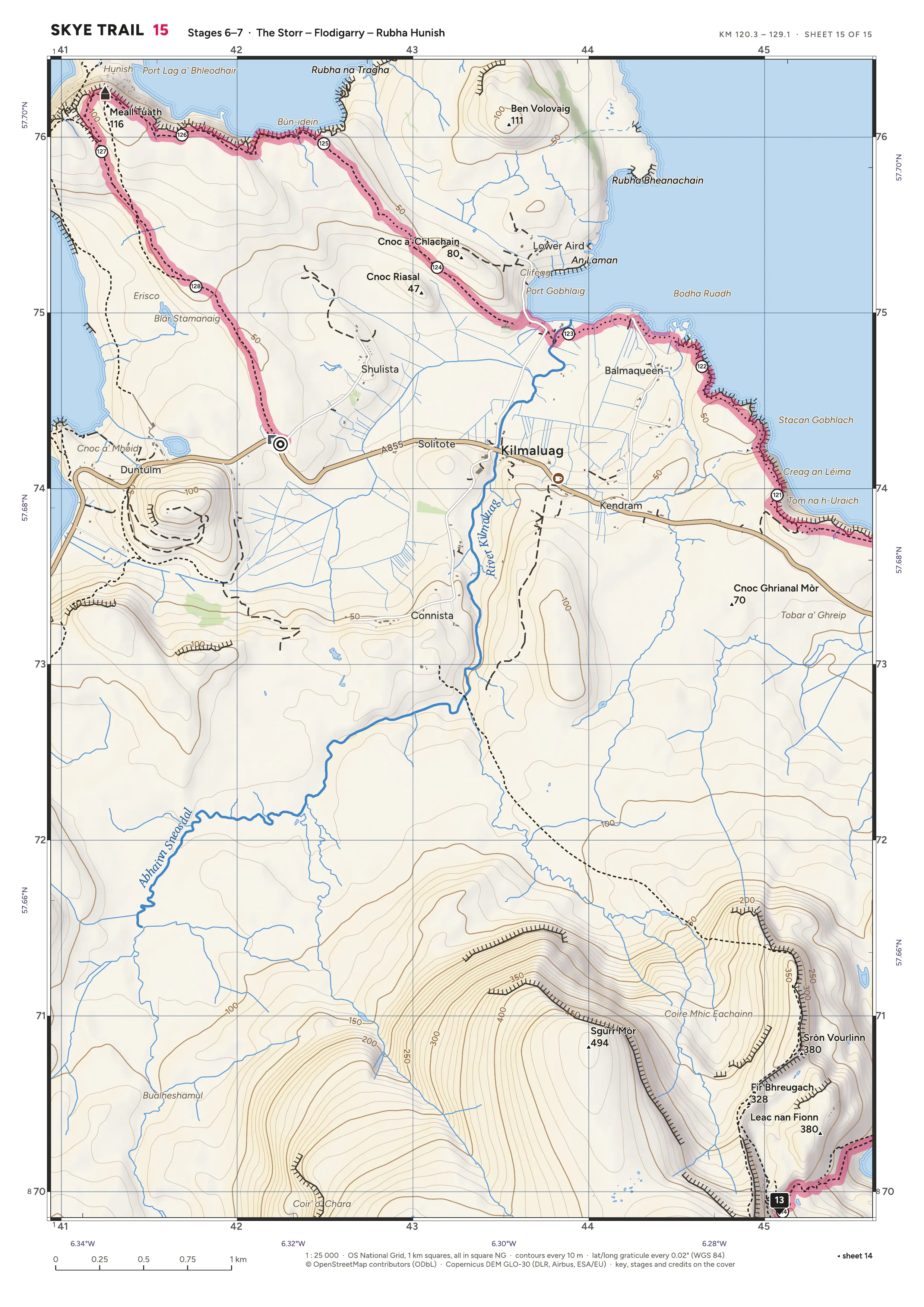
Tap or click a sheet to zoom in. This PDF holds several pages and is not georeferenced, so map apps cannot show your position on it.
Credits
- Map data, names and the route relation © OpenStreetMap contributors, ODbL. openstreetmap.org/copyright
- Terrain produced using Copernicus WorldDEM-30 © DLR e.V. 2010-2014 and © Airbus Defence and Space GmbH 2014-2018 provided under COPERNICUS by the European Union and ESA; all rights reserved. The organisations in charge of the Copernicus programme by law or by delegation do not incur any liability for any use of the Copernicus WorldDEM-30.