Trail maps · Flemish Brabant, Belgium
Leuven
845 km of unpaved trail, 42 drinking-water points and 9 train stations, from Herent to the Meerdaalwoud. Private paths are left out, so check the signs on the ground.
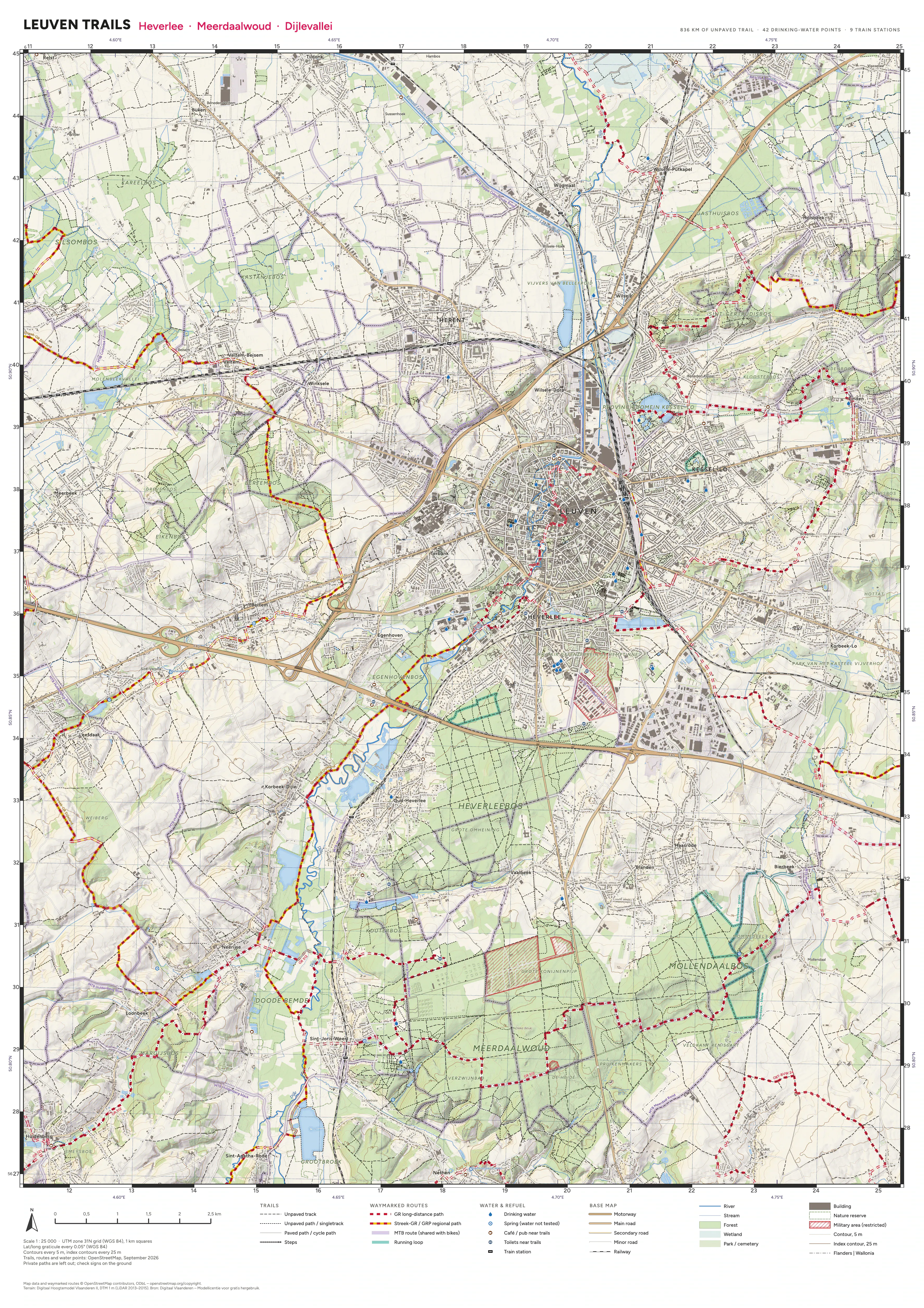
Tap or click a sheet to zoom in. The PDFs are georeferenced, so map apps that read GeoPDFs (Avenza Maps, for one) can show your position on them.
Credits
- Map data and waymarked routes © OpenStreetMap contributors, ODbL. openstreetmap.org/copyright
- Terrain: Digitaal Hoogtemodel Vlaanderen II, DTM 1 m (LiDAR 2013–2015). Bron: Digitaal Vlaanderen – Modellicentie voor gratis hergebruik.